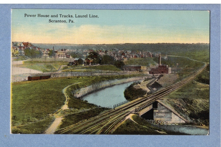
The above photo postcard, taken from a vantage point just east of the Laurel Line yards in Scranton reveals several interesting facts.
The tracks to the right of the photo, heading across the bridge and up the hill, were the original right of way leading to Pittston and Wilkes Barre. Where the tracks disappear half way up the page, the roadbed crested the hill and there was a sharp right turn which headed south, through South Scranton, Avoca, Pittston etc.
The left hand side of the photo shows a double headed train and the power plant. This right of way descended into the valley just past the power plant and then made a right over the Roaring Brook bridge (see other photo in this series) and entered into the north portal of the Crown Avenue Tunnel
The tunnel proceeded for about a mile beneath the South Scranton hills and emerged to intersect with the over the hill route